

Consider the following drawing:
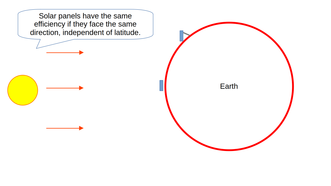
I take it that solar panel’s generated electricity would be the same whether it’s installed in scandinavia or africa, as long as it faces in the same direction? or am i stupid
i’m asking this because everywhere i hear how “solar panels have higher efficiency near the equator”, but that’s just not true. Maps such as these are common on the internet:
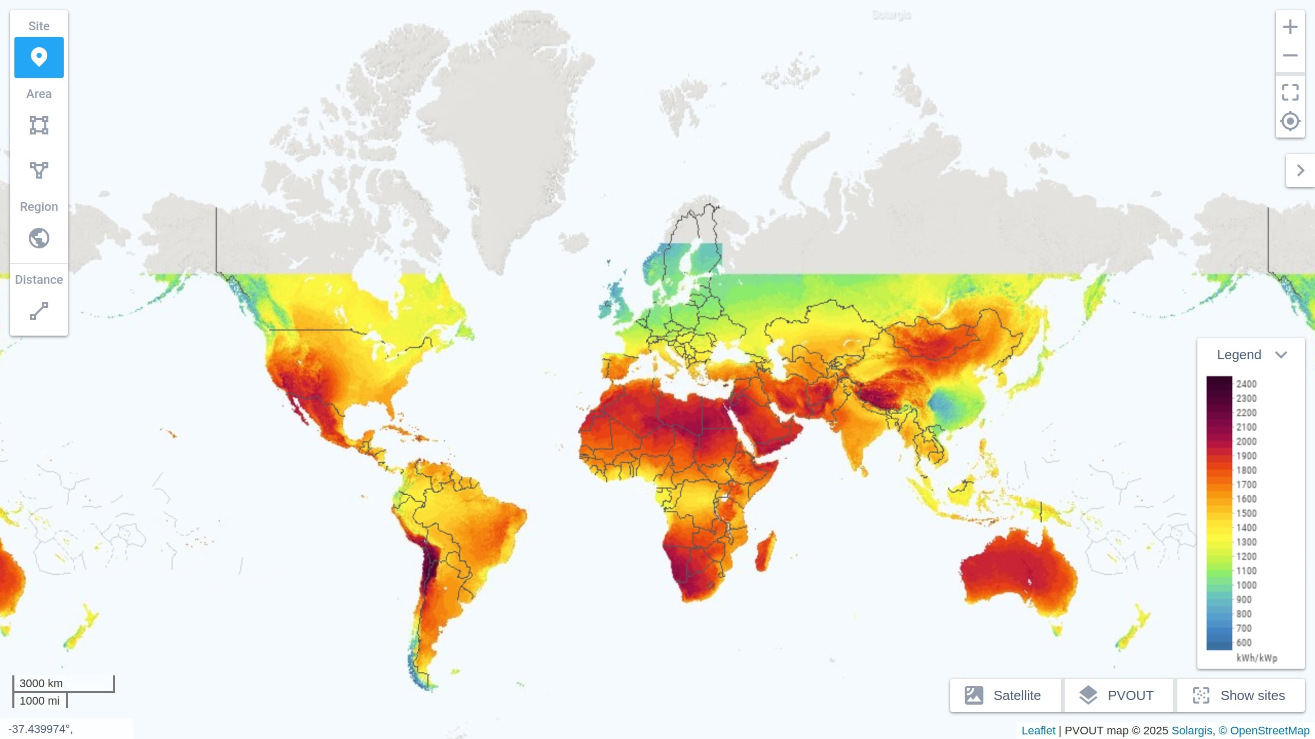
And they suggest that solar energy around the equator would be twice as available as on northern latitudes, but actually that’s just the solar irradiation if the panels weren’t inclined, but in practice, they were likely will be. So they receive similar amounts of power.
edit: so, it’s the cloud cover. got it; thanks :D
I’m no specialist, but (1) don’t most solar panels have a fixed inclination and orientation? Depending on the location that will not be as optimal at each day of the year because of the tilt of the earth. (2) The weather/cliimate will have an effect too. Your 2nd image is apparently showing kWh/kWp - so the longer term yield (h=hours) divided by the theoreticall maximum (p=peak). So it shows longer term efficiency , vs the yield at a certain moment like you appear to be focusing on.
Since the kW part can cancel out, the resulting kWh/kWp value is basically measured in hours. There are 8,766 hours in a year and half of those are at night, so these numbers would make sense if you think of them as “this is how many hours of peak production equivalent you will actually get each year”. You’re in the Sahara, you get the equivalent of 2,400 hours of peak production. You’re in Finland, you get the equivalent of 1,000 hours. If it actually magically ran at the peak production value all year 24/7, you get 8,766.